
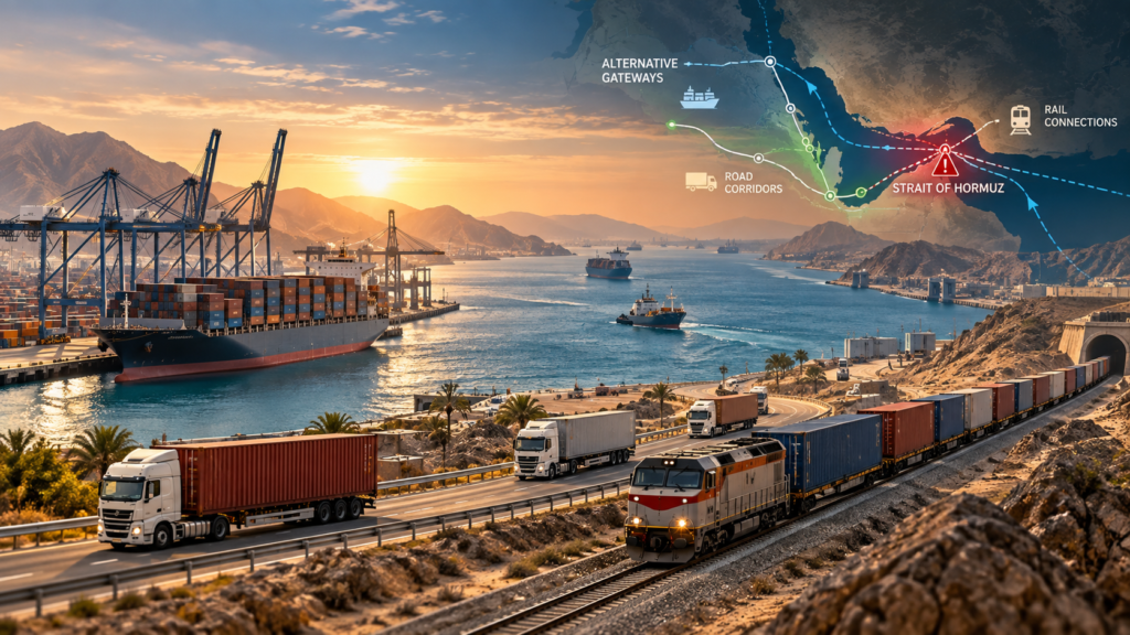
Shipping lines have already built road and multimodal workarounds around the Strait of Hormuz. The harder question for a cargo owner is no longer whether an alternative route exists. It is whether that route can actually carry a specific shipment at the required volume, time and delivered cost.
Since March 2026, major carriers have introduced multimodal services combining maritime transport with inland road and, where relevant, rail connections. The WTO’s current maritime and logistics overview of the Strait of Hormuz disruption documents solutions from MSC, Maersk, CMA CGM, COSCO and Hapag-Lloyd using regional gateway ports and landbridge corridors to maintain access to Gulf markets.
But the existence of those services does not mean inland networks can replace ocean shipping at the same scale.
For shippers, that changes the useful question from “What route bypasses Hormuz?” to:
Which cargo can realistically move overland when maritime access is disrupted?
Current Operating Context
The operating picture is still changing. Late-September data showed some recovery in crude and LNG movements through the Strait, but regional flows remained below pre-conflict levels. In parallel, carrier contingency services remain route-specific rather than universally available. Reuters
Maersk’s September operational advisory makes the practical limitation especially clear: its Gulf landbridge services are subject to availability, and some landside booking lanes had been temporarily paused.
That distinction is central to shipment planning.
A landbridge can exist while the required space for a particular container, date or destination does not.
Key Takeaways
- A Gulf landbridge can preserve connectivity for selected shipments, but it cannot replace ocean shipping at ocean scale.
- Standard containerized freight is generally easier to evaluate for rerouting than bulk, oversized, hazardous or highly specialized cargo.
- The main constraint is often not geography but replacement capacity: ports, trucks, rail slots, terminals, borders and final delivery all have to work together.
- Most current Gulf contingency solutions are multimodal. Rail can strengthen certain inland legs, but there is not yet a seamless end-to-end GCC freight railway.
- A rerouting decision should compare total logistics cost and shipment feasibility, not simply the ocean rate against a truck or rail quotation.
Why a Landbridge Is Not a Direct Replacement for Ocean Shipping
A landbridge uses an overland movement to connect markets, ports or transport networks that would otherwise depend more heavily on maritime access.
A simplified Gulf contingency movement might look like:
Ocean → Port outside the constrained route → Road or Rail → Gulf destination
For another shipment, the architecture could be:
Upper Gulf market → Road → Red Sea gateway → Ocean network
Both are landbridge concepts, but neither means that a container leaves a ship and automatically continues by train.
The WTO’s 2026 record shows that current carrier responses use combinations of maritime shipping and inland logistics. Some are road-led; others can incorporate rail where infrastructure and commercial arrangements allow it.
This is an important misconception to remove:
Landbridge does not mean rail bypass.
For a broader explanation of how ports, road and rail can operate within one logistics chain, see Arta Rail’s multimodal transport in the Middle East guide.
The real constraint is replacement capacity
A container vessel concentrates a very large amount of cargo into one maritime movement. Replacing even part of that volume inland requires enough trucks, rail slots, terminals, drivers, equipment, border-processing capacity and storage at the same time.
A bypass port may physically have room for additional cargo while the inland network behind it does not have enough capacity to move that cargo onward.
This is why the commercially useful question is not whether land transport can “replace Hormuz.”
It is whether an overland route can protect this shipment from the disruption.
Which Cargo Is Easier to Reroute?
Not all freight responds to disruption in the same way.
| Cargo profile | Overland rerouting potential | What must be confirmed |
|---|---|---|
| Standard dry containers | Generally easier to assess | Gateway, capacity, border and final delivery |
| Refrigerated containers | Possible on selected services | Power continuity, monitoring and carrier acceptance |
| Industrial components | Often suitable for evaluation | Dimensions, weight, handling and urgency |
| High-value production inputs | Can justify contingency routing | Security, timing and delivered cost |
| Dangerous goods | Highly route-specific | Regulatory, carrier and border acceptance |
| Out-of-gauge cargo | Case-by-case | Clearance, permits and specialized equipment |
| Bulk commodities | Usually needs dedicated logistics | Terminal, wagon/truck and loading capacity |
| Large recurring volumes | Harder to substitute quickly | Network-scale capacity and equipment cycles |
This is not an acceptance list. It is a way of identifying how much operational validation a shipment will require.
Standard containers have one important advantage
A standard container can often remain the same loading unit while the equipment underneath it changes.
A movement could involve a vessel, truck, terminal and train without unpacking the goods.
That reduces cargo handling, but it does not remove the transport interfaces. The container may still face a truck shortage, terminal congestion, customs restrictions, unavailable rail capacity or an impractical Last Mile.
Container continuity is therefore not the same as transport continuity.
Reefer, hazardous and specialized cargo need another layer of validation
A refrigerated container needs more than physical space. Power availability and monitoring must continue throughout transfer and waiting stages.
Dangerous goods can be accepted by one carrier or gateway and restricted by another.
Oversized cargo may technically fit on a road or rail network but fail because of bridge clearance, terminal equipment or route permits.
For these cargo types, the question “Is there a landbridge?” is far too broad.
What Current Hormuz Workarounds Actually Look Like
The strongest way to understand the 2026 response is to look at the architectures carriers have actually introduced—not just theoretical lines on a regional map.
The WTO records several examples. World Trade Organization
| Documented 2026 pattern | What has been introduced | Planning implication |
|---|---|---|
| Saudi Red Sea gateways | MSC launched inland haulage through King Abdullah Port and Jeddah Islamic Port toward Gulf markets | Useful only where inland capacity and destination access align |
| UAE / Oman outside-Hormuz gateways | CMA CGM identified Khor Fakkan, Fujairah and Sohar among gateways used in multimodal solutions | Port bypass still requires a workable inland leg |
| Multi-country Gulf landbridge | Maersk operates landbridge solutions across several Gulf markets | Availability remains lane-specific and can change |
| Sea–land Gulf service | COSCO introduced combined sea-land solutions for Gulf countries | Commercial service still needs shipment-level confirmation |
| Temporary gateway handling | Hapag-Lloyd introduced alternative container-handling and landbridge measures | Temporary contingency service should not be treated as permanent capacity |
These are examples of announced or operating 2026 solutions, not guaranteed availability for a new booking.
Outside-Hormuz gateway does not mean end-to-end bypass capacity
Ports such as Khor Fakkan, Fujairah and Sohar are attractive because of their geography relative to the Strait.
But moving the vessel call outside the chokepoint solves only one part of the logistics problem.
The cargo still needs:
- discharge and container release;
- customs processing;
- inland equipment;
- road or rail capacity;
- possible border crossings;
- terminal handling;
- and delivery to the consignee.
The chokepoint can therefore move inland rather than disappear.
This is one of the main weaknesses of articles that present alternative ports as if the port itself were the complete alternative route.
Rail vs Road: Which Inland Mode Actually Helps?
The answer depends on what problem the inland leg needs to solve.
When rail adds value
Rail becomes commercially meaningful when it removes a real inland bottleneck or provides a useful high-capacity segment.
The UAE already has an operating national freight railway connecting industrial zones, logistics hubs and ports. Etihad Rail states that freight operations are active across 11 terminals and four major ports, and its network is designed to integrate rail with wider logistics systems.
A particularly relevant 2026 example is the first rail movement of finished vehicles from Fujairah on the UAE’s eastern coast to ICAD in Abu Dhabi. It demonstrates that cargo arriving on the coast outside the Strait can, for suitable shipments, be integrated with an inland railway movement rather than relying only on trucking. Etihad Rail
Saudi Arabia also has operating freight infrastructure. In March 2026, Saudi Arabia Railways launched a corridor linking the ports of Dammam and Jubail with Haditha near the Jordanian border, creating a rail-supported inland route toward northern Saudi Arabia and Jordan.
Rail therefore has a real role—but only where the railway serves the required gateway and destination architecture.
Arta Rail’s international rail freight guide explains why terminal interfaces, equipment, borders and network continuity need to be checked before a railway line is treated as a commercially executable shipment route.
When road is more practical
Road has a different strength: flexibility.
A truck does not require both ends of the journey to have railway access. It can connect a port directly to a border, warehouse, factory or rail terminal.
That makes road particularly useful for emergency rerouting, smaller shipment volumes, First Mile and Last Mile movements, and connections between different transport networks.
But road capacity is not unlimited either.
A surge in diverted containers can create truck shortages, queues, border congestion, permit constraints and higher handling pressure at inland facilities.
Choosing road simply because it is flexible can therefore produce the same mistake as choosing rail simply because tracks exist.
The Gulf Does Not Yet Have a Seamless Cross-Border Freight Railway
This distinction is particularly important when assessing maps of the Gulf.
The UAE and Saudi Arabia operate substantial national freight rail systems, but that does not mean a container can currently move by one uninterrupted railway across the GCC.
The GCC Railway Authority states that December 2030 is the target for full operation of the railway project connecting member states, while bilateral links may open earlier where individual sections are completed.
Even the strategically important Oman–UAE Hafeet Rail project was reported as 40% complete in April 2026, rather than already operating as a finished cross-border freight link. Etihad Rail
So the 2026 reality is more nuanced:
National freight rail exists.
Road landbridges exist.
Multimodal carrier services exist.
But a seamless cross-GCC rail bypass should not be assumed.
Four Things Shippers Should Not Confuse
Several distinctions prevent poor rerouting decisions.
| Do not confuse | With |
|---|---|
| Route existence | Current commercial service |
| Current service | Space for your shipment |
| Rail or road infrastructure | End-to-end operational continuity |
| Alternative routing | Lower total logistics cost |
These differences become more important during a fast-moving disruption because information can become outdated quickly.
A carrier announcement may prove that a service has been launched. It does not prove that space is available next Tuesday for a specific commodity and destination.
A railway map proves that infrastructure exists. It does not prove that the required cargo service, terminal handling and Last Mile connection can be booked.
The Border Can Become the New Chokepoint
Rerouting around a maritime chokepoint may simply move the bottleneck to a land border.
Cross-border movements can depend on customs documentation, transit procedures, cargo inspection, driver and vehicle permits, dangerous-goods rules, working hours and acceptance by the next transport operator.
That means the shortest-looking landbridge is not necessarily the most executable one.
A route that crosses several difficult interfaces may perform worse than a geographically longer route with better operational continuity.
For cargo owners, border feasibility deserves the same attention as port selection.
First Mile and Last Mile Can Change the Decision
Corridor maps usually start and finish at logistics hubs.
Commercial shipments do not.
Consider two containers moving through the same alternative gateway into the same Gulf country.
One consignee may be located close to the gateway or an inland terminal. Another could require a long truck movement through an additional border or several hundred kilometres of road transport. Despite using the same main corridor, the final logistics outcome can be significantly different.
For this reason, a useful routing comparison should start at the actual factory, warehouse or loading terminal and finish at the actual consignee.
Not at “Asia.”
Not at “the UAE.”
And not at two port names.
Freight Rate vs Total Logistics Cost
A landbridge quotation can appear attractive when only the main inland movement is compared.
That is not the complete commercial calculation.
| Cost component | Why it may appear |
|---|---|
| Ocean rerouting | A different gateway or feeder structure is required |
| Port handling | Additional discharge, release or transfer |
| Storage | Cargo waits for inland capacity |
| Road haulage | Main landbridge, First Mile or Last Mile |
| Rail freight | Selected high-capacity inland segment |
| Border operations | International overland movement |
| Terminal handling | Road–rail or container transfer |
| Specialized equipment | Reefer, dangerous or oversized cargo |
| Final delivery | Movement from last hub to consignee |
A route with a lower inland freight rate can still produce a higher delivered cost if it creates additional storage, border or handling stages.
The relevant comparison is therefore Total Logistics Cost, not simply the cheapest quoted leg.
Example: Four Containers vs 200 Containers
Consider a manufacturer moving four standard dry containers from Asia to a factory in an Upper Gulf market.
If normal maritime access is constrained, the cargo may be discharged at an alternative gateway and delivered by road—or by a combination of road and rail—provided capacity, customs and equipment are available.
Now change only the scale.
Instead of four containers, the manufacturer needs a recurring flow of 200 containers.
A route line on the map may remain exactly the same, but the commercial question changes at a larger scale. At that point, the shipper must confirm whether the port, truck fleet, railway, terminal and border system can repeatedly absorb the required volume. Geography stays the same, while the capacity requirement changes significantly.
A Practical Hormuz Rerouting Framework
Before comparing rates, a shipper should validate the movement in this order.
1. Define the cargo. Confirm commodity, packaging, dimensions, weight, container type, temperature requirements, dangerous-goods status and special handling.
2. Confirm the exact origin. A country is not an origin. Use the actual factory, warehouse, terminal or port.
3. Confirm the final destination. A country or port is not the final delivery point.
4. Identify the real Hormuz dependency. Determine which part of the existing logistics chain is actually affected.
5. Select a realistic alternative gateway. Geography alone is not sufficient; carrier service and cargo acceptance must be checked.
6. Design the inland movement. Decide whether road, rail or a combination of both solves the transport requirement.
7. Map every interface. Port, customs, truck, border, rail terminal and final delivery each require validation.
8. Confirm current service availability. Historic service or an old announcement is not enough.
9. Confirm capacity for the specific shipment. Nominal infrastructure capacity is different from bookable capacity.
10. Add First Mile and Last Mile. Do not leave them outside the comparison.
11. Calculate Total Logistics Cost. Include handling, storage, borders, equipment and final delivery.
12. Reconfirm immediately before booking. During disruption, service conditions can change quickly.
When Does a Landbridge Make Commercial Sense?
A Gulf landbridge deserves serious evaluation when the cargo is compatible with inland transport, a practical alternative gateway is available, the required capacity can be confirmed, border operations are workable and the final destination can be reached without creating disproportionate cost or complexity.
Time sensitivity can also change the business case.
A manufacturer facing a production stoppage may rationally accept a more expensive rerouting option for a few critical containers.
That does not mean the same architecture makes sense for a routine, low-value or very high-volume commodity movement.
Landbridges are therefore often better understood as a resilience tool for selected cargo flows than as a permanent one-for-one substitute for ocean shipping.
When Might Rerouting Not Make Sense?
The original maritime architecture may remain more practical when:
- the cargo volume is too large for available inland capacity;
- specialized equipment cannot be secured;
- too many transfers or borders are added;
- the alternative gateway creates an excessive First or Last Mile;
- the service exists in principle but is not accepting the required booking;
- or the complete delivered cost becomes commercially unreasonable.
A disruption creates a reason to re-evaluate the route. It does not automatically create a better alternative route.
In some cases, the better decision may be to delay departure, change the maritime gateway, split the cargo across different modes, or keep part of the original ocean architecture.
What Should Be Confirmed Before Booking?
Before a rerouted shipment is treated as executable, confirm the cargo description, HS code where relevant, equipment type, weight and volume, loading point, final delivery point, alternative gateway, current carrier acceptance, inland capacity, border requirements, terminal arrangements and storage exposure.
Security, customs, sanctions and regulatory requirements also need to be checked against the actual cargo, parties and countries involved.
A transport corridor should never be treated as evidence that every transaction using that corridor is legally or commercially executable.
Planning the Next Step
A Strait of Hormuz shipping disruption should trigger route validation, not automatic mode switching.
The useful sequence is:
Cargo → Origin → Destination → Alternative Gateway → Inland Mode → Interfaces → Capacity → Total Logistics Cost
Once the actual cargo, loading point, destination, shipment size and equipment requirements are known, they can be shared with Arta Rail for route and commercial evaluation.
The objective is not to assume that rail or road can replace the original ocean route. It is to determine whether an alternative origin-to-destination logistics architecture can actually be executed under current operating conditions.